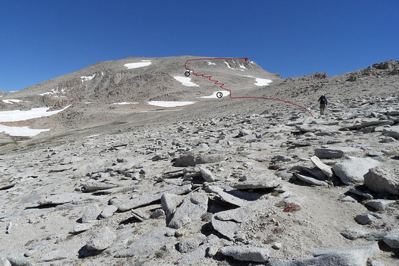
Jim and Approximate Route to the Top
Upon talking with a another hiker, we used two snowfields as waypoints; a larger snowfield (circled 1), followed by a series of switchbacks and cairns, which then led to a smaller snowfield (circled 2). Just above the circle-2 snowfield, very large cairns marked a steepening of the route (see shots 82-83), so we had to scramble among the boulders for a short time until the angle eased-off as we approached the summit plateau.